History
The historic neighborhood of Western Heights contains 175 parcels, 127 identified as Contributing, and 48 as Non-Contributing resources, with structures that date back to the late 1800s. Used for agriculture starting with the Spanish land grant that established the City of Los Angeles, streetcar extensions facilitated the neighborhood’s development into a suburban enclave for families who worked downtown. Despite the change that has come to the commercial storefronts of Washington Blvd which border the area, the neighborhood has remained mostly unaltered in the last 80 years, with over 70% of the buildings still retaining the character that makes them historic. It is considered one of the most intact of the city’s Historic Preservation Overlay Zones.
The Western Heights area is immediately west of the original land grant given to Spanish settlers in 1781. Lands outside of the land grant were supplemental to the pueblo lands and were controlled first by the Spanish and then by the Mexican Governors of Alta California, and then by the United States after 1847. Until the later part of the nineteenth century, the area including Western Heights was used exclusively for grazing and agriculture. Portions of the area were subdivided for residential and commercial use beginning in the late 1880s.
Suburban neighborhoods were developed in response to the extension of local horse-drawn streetcar routes coming out of downtown Los Angeles. Significant suburban communities were created in the late 1800s including the eastern section of the West Adams District and the University District. The horse-drawn streetcar lines were quickly subsumed by the Los Angeles Transit Lines and Pacific Electric Railway system and upgraded to electric routes, further spurring development southward in the first decade of the twentieth century. By 1910 only small sections of the area west of the original pueblo were still used agriculturally; most of the land had been subdivided into residential tracts.
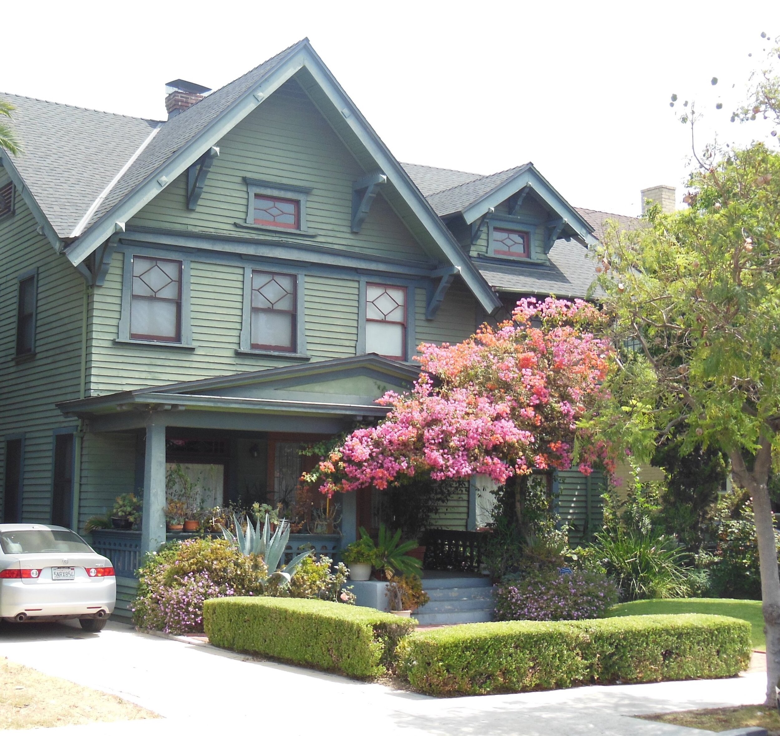
Scotton House
2209 W. 20th St.
Carol Cruzen Collection
Streetcar Development & Annexation
The first local streetcars reached the area around Rosedale Cemetery and the University District in the early 1890s, prompting the migration of wealthy businessmen from downtown Los Angeles. The first east-west streets to become major thoroughfares included Pico, Washington and Jefferson Boulevards. While the railroads and Pacific Electric system spurred the growth of outlying communities, local streetcars, begun as independent franchises using horse-drawn cars, also spurred development within the residential subdivisions close to downtown Los Angeles. All of the local streetcars were later electrified and eventually absorbed into the Los Angeles Transit Lines (the “Yellow Cars”). Usually there was a direct relationship between the streetcar routes and the development of residential tracts. Other significant streetcar routes included the Washington Street line to Rosedale Cemetery (1895). Development of each line was motivated by the desire to sell real estate in the area. The resources associated with rail transportation include depots, platforms, substations, and track right-of-ways.
As residential communities developed, citizens increasingly perceived a need for services beyond those provided by the initial subdividers and real estate entrepreneurs. Primary among these services were water distribution and law enforcement, which often implied a regulation and curtailment of liquor consumption. As a result of these needs, areas west of the Pueblo were annexed to the City of Los Angeles. The Southern and Western Addition of 1896 was the third annexation from when the city was first founded, and included over ten square miles in two roughly rectangular sections adjacent to the original city boundaries; Western Heights was included in this annexation.
The availability and distribution of water for agricultural and residential use was of primary importance in every area of Los Angeles. Concern about water was one of the most common motivations for annexation to the City of Los Angeles and, as a result, water was an important catalyst in the political development of the region as well as in the determination of agricultural and residential land use. In other parts of South Los Angeles, artesian wells were the primary source of water. Although none of these structures exist in Western Heights, nearby the resources associated with water distribution include artesian wells as well as the larger distributing stations erected by the Department of Water and Power in residential areas during the 1930s.
Residential Development
The residential development of Los Angeles from its first settlement until 1950 was a powerful and persistent factor in the organization of the community’s built environment. The routes of streetcars and electric railways in most cases determined the first areas of concentrated residential development and hastened the “suburbanization” of outlying farm communities. Many residential neighborhoods were developed in very short periods of time by single developers. As a result they demonstrate a consistency of architectural style, size, and scale. In other areas, residential development occurred over two or three decades and continued to change as older structures were replaced by newer ones. These neighborhoods evolved a variety of characteristics that today document changes in population, income level, and in the architectural conventions preferred by successive generations.
The original subdivisions that composed the survey area were:
Orange Crest Tract between Washington Boulevard on the north and 20th Street on the south, and the line of the Cribb & Sinclair’s West Garfield Heights Tract on the east and Arlington Avenue on the west.
Cribb & Sinclair’s Garfield Heights Tract between Washington on the north and 21st Street on the south, and Gramercy Place on the east and Cimarron on the west.
Cribb & Sinclair’s West Garfield Heights Tract between Washington Boulevard on the north and 21st Street on the south, and Cimarron on the east and on the west the boundary lines of the Orange Crest Tract north of 20th Street and the Robert Marsh & Co.’s Florence Heights Track south of 20th Street.
Robert Marsh & Co.’s Florence Heights Tract between 20th Street on the north and 21st on the south, and the boundary line of the Cribb & Sinclair’s West Garfield Heights Tract on the west and Arlington on the west.
Kinney Heights Tract between 21st Street on the north and 23rd Street on the south (the lower portion of this tract is now south of the I-10 Freeway, and Gramercy Place on the east and Arlington on the west.
Belvedere Heights Tract between Washington on the north and 21st Street on the south, and the boundary line of the Robert Marsh & Co.’s Western Heights Tract on the east and Gramercy Place on the west.
Robert Marsh & Co.’s Western Heights Tract between Washington on the north and 21st Street on the south, and Western on the east and the boundary line of the Belvedere Heights Tract on the west.
Brauer House
2129 W. 21st St.
Don Lynch Collection
Single Family Homes
Home ownership was a cultural value embraced by almost every generation and ethnic group of settlers that came to California when residential subdivision began in the 1880s. Many local real estate entrepreneurs capitalized on the universal desire to own property. Prior to that time structures from the early Spanish and Mexican periods were constructed of adobe. Associated with agricultural land uses, the adobe ranch house was later joined by the first wood frame farm houses constructed by American immigrants from the East and Midwest. The farmers from Maine built two story frame houses much like the ones they remembered in New England. As residential subdivision gained momentum, the adobe homestead and the Maine farmhouse were joined by a proliferation of one story Craftsman and period revival style bungalows, in keeping with the architectural styles popular at the time.
Subdivisions west of downtown, often near or adjacent to prestigious Adams Boulevard, were directed at wealthy middle-class families rather than the working class that populated other sections of the city. As a result, the homes were large and lavish. The first wave of concentrated residential development in eastern West Adams and the University District consisted largely of Los Angeles businessmen and their families who wished to move out of the central city but needed to remain within easy commuting distance of downtown.
The streetcar systems that traversed Pico, Washington, and Jefferson initially made this kind of suburban settlement possible. Men of means who had achieved a certain wealth and stature in Los Angeles constructed large residences in the area from 1890 into the 1920s. As a result of the overwhelming desire for home ownership and the subdivision patterns, the single family home was the predominant resource type of residential development in Western Heights. House type, size, site characteristics, and architectural style varied greatly from community to community, but the subdivision of tracts into lots for single family homes proceeded at a relentless pace throughout the region in the early decades of the 20th century.
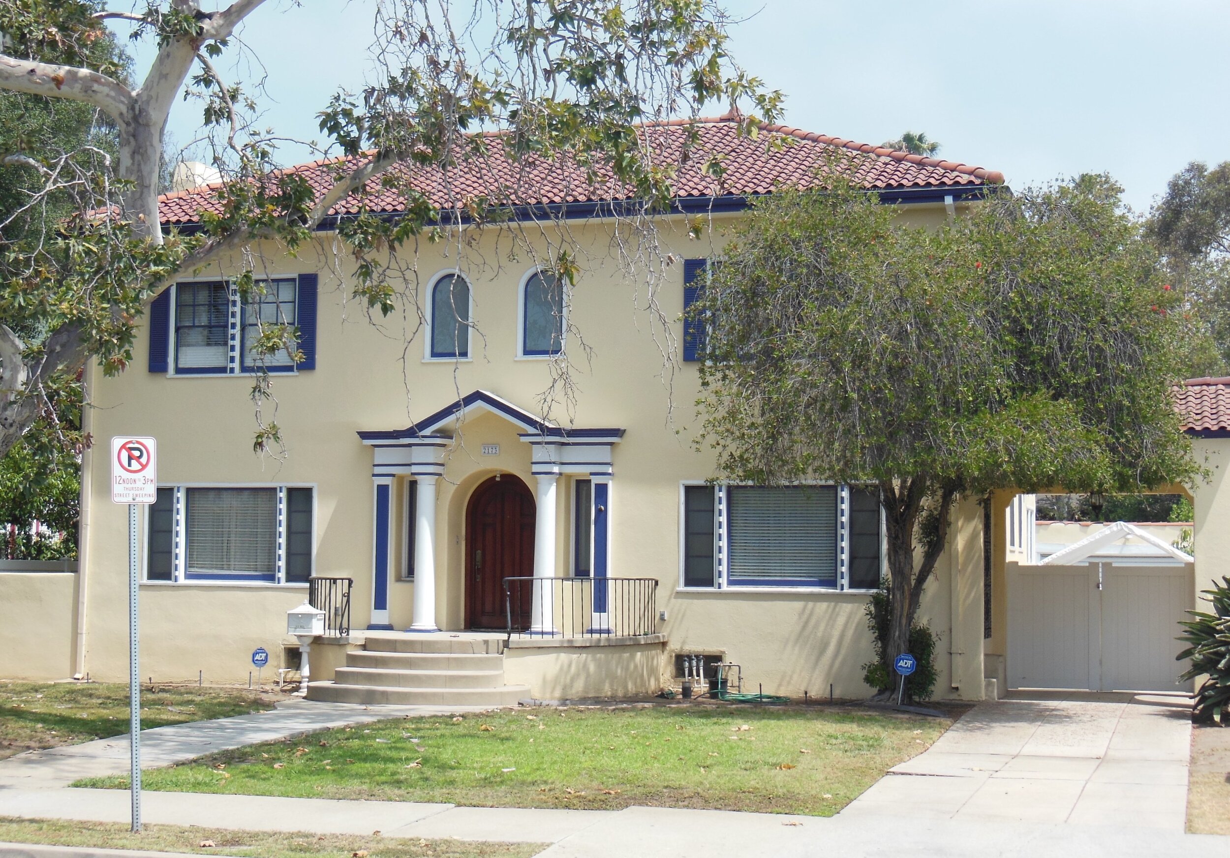
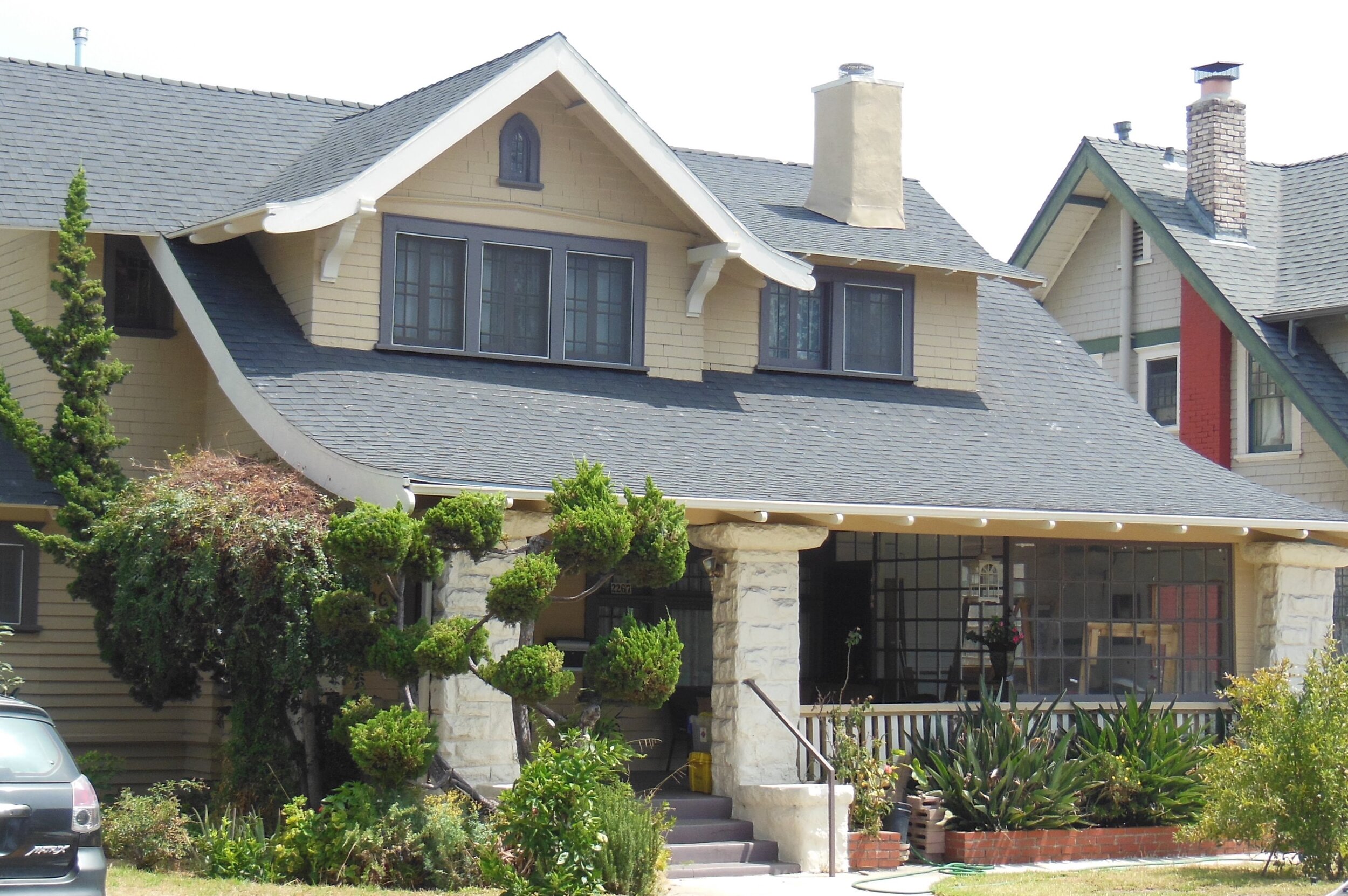
The close proximity to Berkeley Square, a prestigious neighborhood housing some of the largest mansions in Los Angeles, made Western Heights a particularly desirable location to build and own. Single family homes in Western Heights include a broad range of styles and scale. Craftsman houses included the stone foundations, porch supports, and chimneys that typified the style. Wood sheathing or shingles, protruding rafters, the low, horizontal emphasis, and other hallmarks combined to create a regional aesthetic loosely derived from the Arts and Crafts Movement in England and America. Colonial Revival examples typically included a symmetrical facade with columns flanking the doorway. Clapboard sheathing and clipped gable roof forms were also typical. The Spanish Revival and Mission styles had stucco walls, red tile roofs or overhangs, and frequently incorporated arched windows and details as well as other elements derived from the California missions. Tudor style homes included steeply pitched roofs and stucco and half-timber wall designs.
The works of many distinguished local architects are found in South Los Angeles including Sumner Hunt, Theodore A. Eisen, Carroll H. Brown, John Parkinson, Hudson and Munsell, Frank M. Tyler, and many. Designed for specific clients or speculative builders, the works of these architects graced subdivisions owned and promoted by entrepreneurs such as Frederick Rindge and George Ira Cochran of West Adams Heights, Abbot Kinney, who later founded the resort community of Venice. A concentration of these structures in neighborhoods and districts collectively tell the story of residential development in Los Angeles.
After World War I, and with the development of the automobile, those desiring large new homes chose to build even farther west in newer neighborhoods. As a result, many of the lots in Western Heights which had not yet been built upon saw the development of high-end multi-family housing in the form of duplexes, triplexes and fourplexes, as well as a large apartment building on the corner of 20th and Arlington.
Western Heights, today Los Angeles, figured prominently in the fight for the removal of restrictive covenants from its neighborhoods, and in the waning days of such restrictions Western Heights became racially mixed, with many families of color becoming some of its most long-lasting residents. By the 1980s Western Heights was recognized as one of the most racially diverse neighborhoods in the United States and remains so to this day with an unusual variety of races, nationalities, and religions for such a relatively small neighborhood.
-Thank you to Don Lynch and Carol Chacon Allen for their contributions to this section.


